 Illinois alumnus Nama Budhathoki recognized the need for better documentation of Nepal’s roads and resources before disaster struck there last month. The former GSLIS student and a small team of volunteers began mapping Nepal in 2013, after Budhathoki saw the importance of accurate maps following the devastating earthquake that struck Haiti in January 2010.
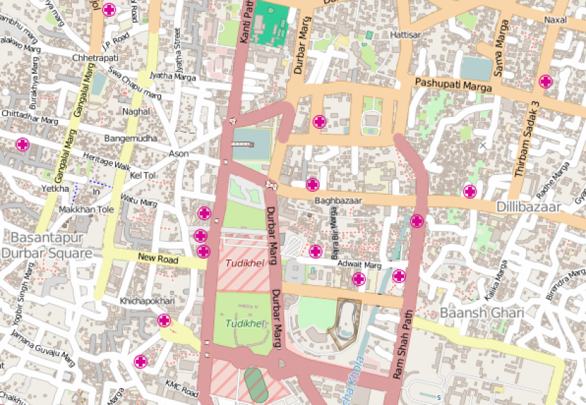
"Navigation in Kathmandu [was already] a nightmare; we don't have a very good address system. If you get an invitation to dinner, to reach that house you have to make six or seven calls to get directions,” he told BBC News.
"Nepal sits in one of the most risky zones for earthquakes and other disasters. In Haiti they made [the map] after—I wanted to make the map before the earthquake."
Budhathoki created the nonprofit organization Kathmandu Living Labs, through which he and his team have been creating maps of Nepal’s Kathmandu Valley using OpenStreetMap (OSM), an initiative that draws on volunteers from around the world to supply local knowledge to build open data maps. Budhathoki studied OSM extensively as a doctoral student at Illinois. He took courses at GSLIS and completed a PhD in urban and regional planning with a dissertation that focused on OSM as a case study to explore the motivations of those who choose to contribute to open source geographic systems.
“Nama’s work is of the highest technical standards. Beyond that, he has shown innovative ways in which technical skills can be employed to benefit those in the greatest need," said GSLIS Professor Emeritus Chip Bruce. Budhathoki worked with Bruce as a research assistant at GSLIS and Bruce served as research director for his dissertation.
Budhathoki, who lives in Nepal, quickly rallied his team following the 7.8 magnitude earthquake that occurred on April 25. Since then more than 4,000 volunteers from around the world have contributed to OSM’s maps of the affected regions, sharing data that is available to aid relief efforts there.
Budhathoki’s other work in LIS includes publication of the book, Youth Community Inquiry: New Media for Community and Personal Growth, which he co-edited with Bruce and Associate Professor Emerita Ann Bishop. He has also taught in LIS topics including geographic information systems, on which he gave a workshop at GSLIS in 2008. In 2013 Budhathoki and former GSLIS Professor Caroline Haythornthwaite received the Best Social Informatics Paper Award from the Association for Information Science and Technology Special Interest Group for Social Informatics for their paper, “Motivation for open collaboration: Crowd and community models and the case of OpenStreetMap.”
Previously, Budhathoki was a research assistant on GSLIS's Youth Community Informatics project, led The World Bank’s Open Data for Resilience Intitiative, served as director of programs at the Niti Foundation, held a post-doctoral research position at McGill University, and was an information technology officer for Nepal’s Ministry of Land Reform and Management.
The work of Kathmandu Living Labs and OpenStreetMap were recently featured in news items published by BBC News and Wired.